 | ||||||||||||||||||||
 | ||||||||||||||||||||
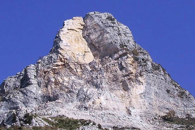
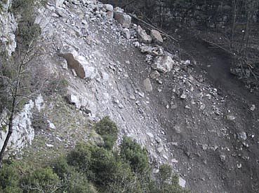
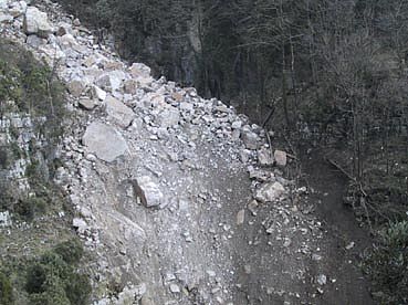
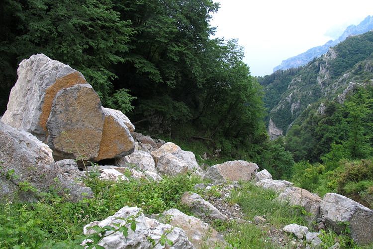
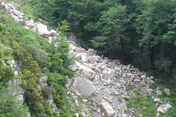
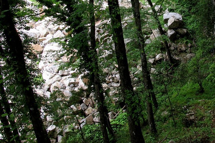
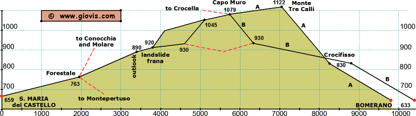
Il 4 gennaio 2002 una frana di 6000 metri cubi si staccò dalla cima di Monte Catello e scendendo lungo il Vallone Porto fece sparire un tratto del il sentiero Forestale - Capo Muro. Una variante supera ora la frana passando a monte del vecchio sentiero.
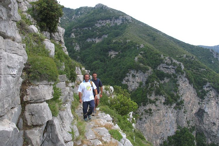
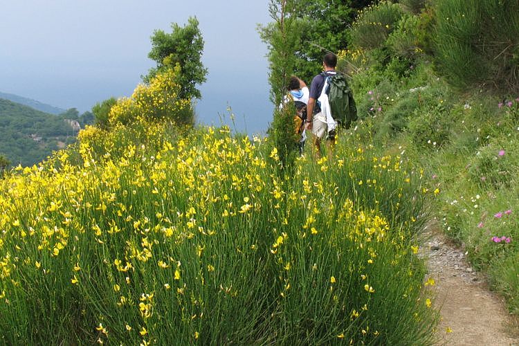
Lasciate S.Maria del Castello seguendo verso est il segni bianco-rossi dell'Alta Via dei Monti Lattari e dopo un paio di km raggiungerete il trivio a monte della Forestale. Il sentiero a sinistra sale ripido verso la Conocchia ed il Molare, quello a destra va a Montepertuso; proseguite lungo il sentiero centrale. Percorrete 1,5km e sarete su una terrazza (890m) con un gran panorama e molto vicini alla frana. Dopo altri 200m attraversate un valloncino e subito dopo si sale per un centinaio di metri lungo il nuovo tracciato fino a raggiungere la frana.
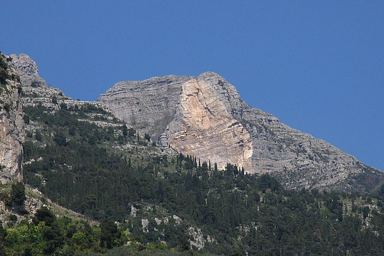
Da questo punto esistono adesso due attraversamenti della frana ed entrambi consentono l'accesso a Capo Muro: 1- seguendo i segni verso monte si arriva all'inizio di un sentiero di recente ripristinato che vi porterà comodamente (ma dopo una breve ripida scalinata) fino a Capo Muro. Il sentiero è molto evidente, ma al momento senza segnavia. 2- seguendo i segni verso valle si arriva ai piedi della parete rocciosa, si risale per un po' ed infine si scende una ripida scalinata che vi riporta sul vecchio tracciato. Uscendo dalla valle prestate attenzione ad un bivio: il sentiero a sinistra (spesso meno evidente) è quello per Capo Muro con segnavia CAI, quello che scende verso destra (di recente risistemato) vi porta verso Vagnulo/Nocelle. Si prosegue quindi per poco più di 500m e a questo punto si dovrà iniziare a salire fra la bassa vegetazione che spesso copre i segni bianco-rossi. Ad un centinaio di metri di quota più in alto seguite verso destra il chiaro sentiero che, aggirando un ampia valletta (circa 600m in leggera salita), vi condurrà fino al "fungo" di Capo Muro (1079m).
Di qui il sentiero scende verso sud-ovest lungo il crinale (una pietraia) fino a trovare un sentiero in quota a circa 150m di quota più in basso. Questo sentiero vi porterà sulla rotabile di Paipo e quindi, con qualche chiara scorciatoia, a Bomerano. Da Capo Muro parte anche il sentiero verso nord-est che aggirando Monte Catello conduce a Colle Garofalo da dove potrete salire al Molare o scendere ad Agerola o continuare lungo il sentiero 00 verso est. Da Capo Muro c'è anche la possibilità di proseguire lungo il crinale (a sud-est) verso Monte Calabrice e Monte Tre Calli (1122m) e quindi scendere a Bomerano (633m). |
|
On the 4th of January 2002 about 6.000 cubic meters of boulders and stones fell in a landslide from Monte Catello down along the Vallone Porto cutting off the trail Forestale - Capo Muro. A detour crosses now the landslide higher than the old trail.
Leave S.Maria del Castello and follow the red-white signs of the Alta Via dei Monti Lattari eastward; after a couple of km you'll come to the crossroads just above the Forestale stone building. The left trail goes steeply up to Conocchia and Molare, the right one descends to Montepertuso. Keep going along the central one and after 1.5 km you'll come to a natural terrace (890m - gorgeous views) and the landslide is now just a few meters away. About 200m ahead you'll cross a rivulet and soon after go uphill for about 100m along the new trail till you reach the edge of the landslide.
From there you can now climb up or down along two marked crossings which lead to two different trails: 1- going up you'll get to a recently maintained trail that after a short climb (log and stone steps) becomes less steep and very easy to follow but at the moment there are no trailmarks. 2- going down you'll reach the foot of the cliff, go up for a few meters and and then steeply down (log steps) to the old route. Leaving the valley pay attention to a fork: the trail to your left (often not very evident) is the Capo Muro one with white/red trailmarks, the one to the right (recently maintained) goes downhill towards Vagnulo and Nocelle. After about 500m you have to start climbing through the low bushes that often hide the red-white signs. About 100m higher you'll find a clear path: follow it to the right. Going gently up around a valley for 600m, it will lead you to the "mushroom" of Capo Muro (1079m).
From that saddle the trail goes down along the ridge (stony ground) to a clear path about 150m lower that will take you to the road of Paipo and then, following a couple of easy to spot shortcuts, to Bomerano. From Capo Muro two more important trails start: the one towards north-east going around Monte Catello leads to Colle Garofalo from where you can go up to Molare or down to Agerola or continue along the 00. The other one goes south-east along the ridge, passes Monte Calabrice and Monte Tre Calli (1122m) and finally descends to Bomerano (633m). | ||||||||||||||||||
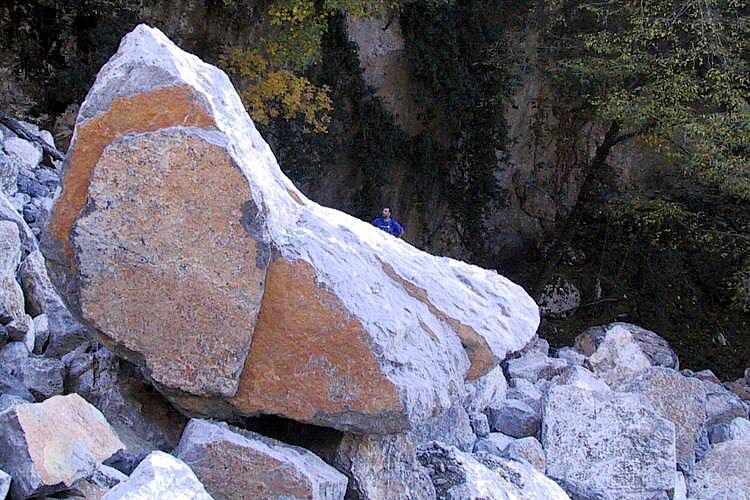
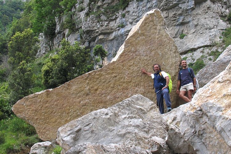
2 foto del vecchio sentiero interrotto / 2 photo of the end of the old trail
| ||||||||||||||||||||