
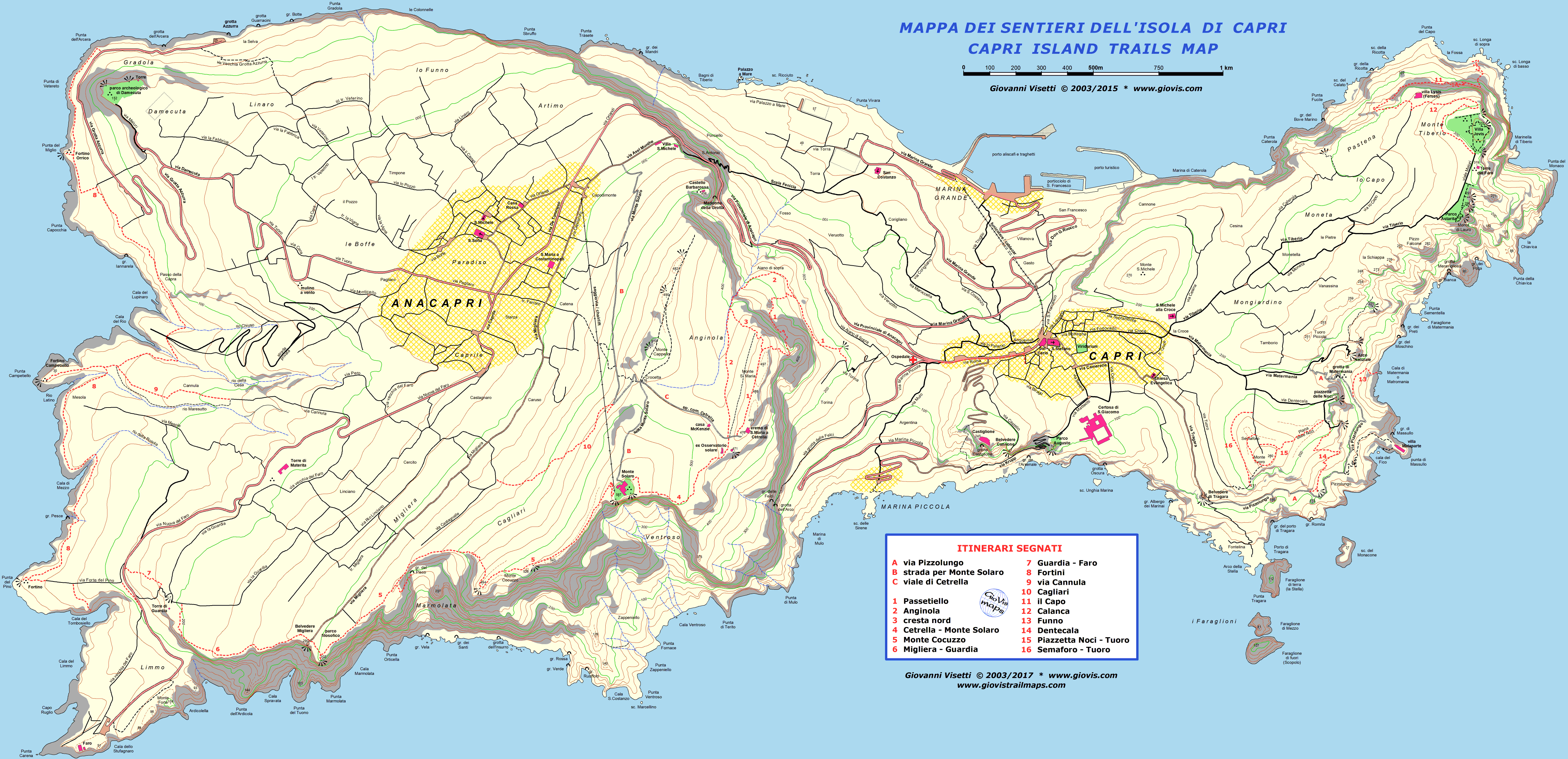
|
i Fortini Borbonici dalla Grotta Azzurra a Punta Carena
|
Anche l'itinerario dei Fortini Borbonici è breve ma può essere unito ad una visita al Parco Archeologico di Damecuta (ingresso libero) o ad una nuotata (anche se non sempre la risalita da mare è semplice se non a Punta Carena).
Può essere percorso indifferentemente in un senso o nell'altro ed è possibile raggiungere sia la Grotta Azzurra che il faro di Punta Carena con servizio bus pubblico.
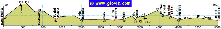
Qui viene descritto, da sud a nord, solo il percorso vero e proprio (da strada a strada) tralasciando gli evidenti tratti fra esso e gli stazionamenti dei bus.
Dalla rotabile si scende, diritto verso il mare, lungo una stradina cementata e dopo circa 200m vale la pena effettuare una breve deviazione a sinistra per raggiungere la postazione di Tombosiello (non un fortino vero e proprio); vista su Cala del Limmo e faro.
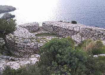
Tornati sulla stradina, continuate a scendere fino al Fortino del Pino (ultimo tratto sterrato). Dopo una congrua sosta, risalite lungo lo stesso sentiero per pochi metri ed imboccate, a sinistra, il Sentiero dei Fortini vero e proprio.
Dopo circa 600m, e vari saliscendi fra rocce e macchia, troverete il ponte di legno (brutto ed inutile) che attraversa il rio Rosola e vi porta a Mesola. Altri 600m e siete al bivio per il Fortino di Mezzo, che raggiungerete procedendo verso il mare per circa 250m.
Provenendo da Mesola potete anche utilizzare una scorciatoia scendendo nella valletta e passando vicino ai ruderi di una calcara.
Tornate al bivio e procedete verso l'interno della valle fino ad attraversare il rio Cesa e il rio Chiuso, poi salite fino al punto più alto del percorso (78m) avendo a destra una parete rocciosa. Dopo un paio di centinaia di metri c'è la prima delle traverse che salgono alla rotabile della Grotta Azzurra.
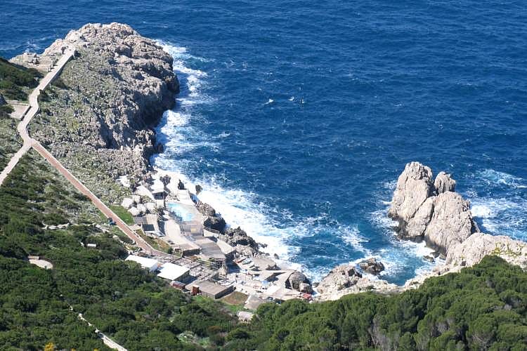
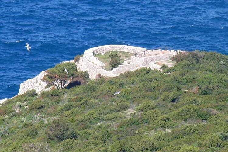
Continuate a scendere, superate la seconda traversa, e dopo altri 200m siete al Fortino Orrico. Il sentiero prosegue per altri 500m circa fino alla rotabile, a poche centinaia di metri dalla Grotta Azzurra, in corrispondenza della curva sovrastante Punta dell'Arcera.
|
Video: VIDEOCLIP HQmap: map Capri |
 |
 |
 |
 www.maratrail.com |
 www.giovistravels.com |
|
Blockhouses trail
from Grotta Azzurra to Punta Carena
|
The itinerary of the Bourbon Blockhouses (Fortini Borbonici) is also short, but you can add a visit to the archaelogical site of Damecuta (free admission) or a swim (even though coming back ashore is not always easy unless at Punta Carena).
You can walk it in either direction and you can reach both the Grotta Azzurra and the lighthouse of Punta Carena by public bus.
Here I describe just the actual trail, northbound and from road to road, leaving out the two easy stretches between it and the bus terminals.
From the main road of Punta Carena, walk down along a concrete minor road towards the sea and after about 200m it's worth making a detour to the left in order to reach the lookout of Tombosiello (not a real blockhouse); views of Cala del Limmo and the lighthouse.
Go back to the minor road and walk down to the Fortino del Pino (last part unpaved). After a due pause, go back up for a few metres along the same path and take, to the left, the Bourbon Blockhouses trail.
After about 600m, and some ups and downs through rocks and shrubs, you reach a wooden bridge (ugly and unnecessary) that goes across rio Rosola and takes you to Mesola. About 600m further on you'll be at the fork to the Fortino di Mezzo, that you'll reach going towards the sea for 250m. Coming from Mesola you can also take a shortcut that goes down in the narrow valley passing a few metres away from the ruins of a limekiln.
Go back to the fork and continue up towards the inner part of the valley and cross rio Cesa and rio Chiuso, then walk up along the cliff till you reach the highest point of this hike (78m). After a couple of hundred metres you'll meet the first of the side paths linking this trail to the Grotta Azzurra road.
Continue downhill, pass the second side path, and 200m after it you'll get to Fortino Orrico. The trail continues for about 500m till you reach the road, a few hundred metres uphill from the Grotta Azzurra, on the bend overlooking Punta dell'Arcera.
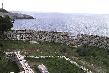
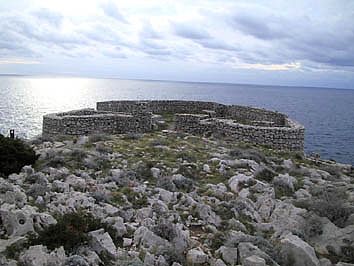
Fortino del Pino Mesola o "Fortino di mezzo"
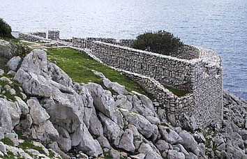
Fortino di Orrico Tombosiello