
|
da Agerola ad Amalfi San Lazzaro > Acquolella > Pogerola > Amalfi |
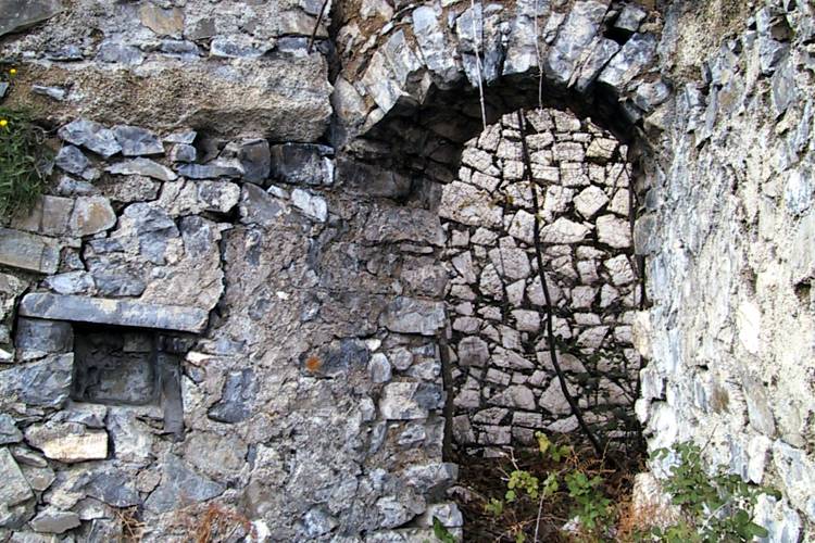
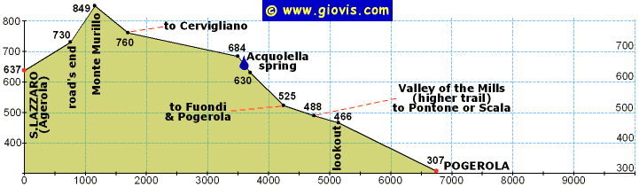
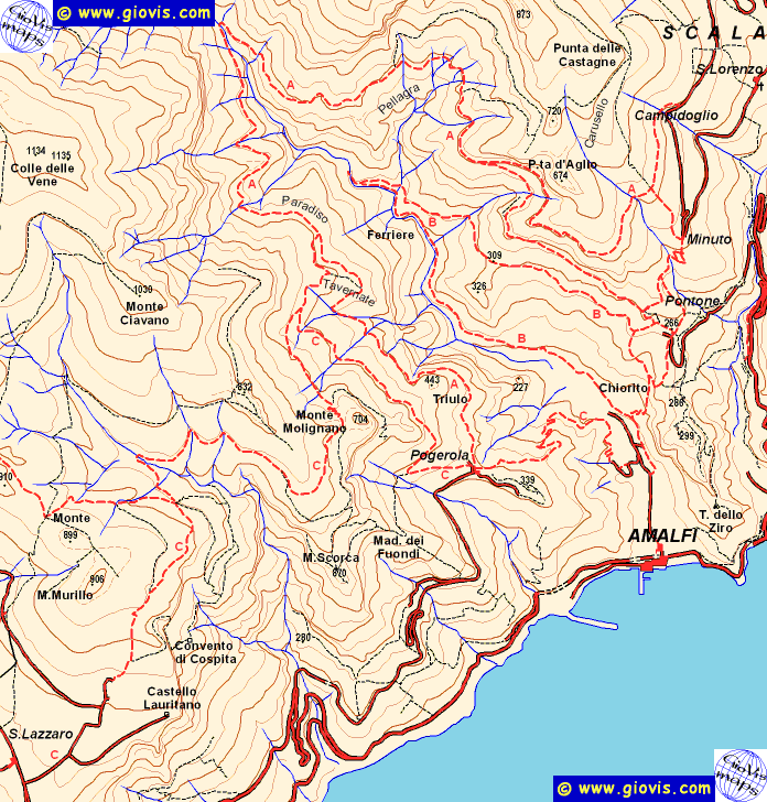
Da San Lazzaro (Agerola), quasi a metà strada fra la piazza ed il Belvedere, salire a sinistra verso il Castello Lauritano. Dopo pochi metri si lascia a destra il bivio per il cosiddetto castello (vale la pena andarci solo per il panorama), ma noi proseguiamo diritti fino alla fine della strada asfaltata (730m).
Qui si passa su un sentiero, ma si continua a salire per la massima pendenza; arrivati nella parte alta, ma non in cima a Monte Murillo (910m, alla nostra sinistra) si dovrà prendere il sentiero a destra in discesa che in circa 500m si congiungerà con l'Alta Via dei Monti Lattari in corrispondenza di un tornante: continuare a scendere diritti.
Dopo poco il sentiero spiana e rimane in quota per un lungo tratto aggirando tutta la valle. Poco prima di uscire dalla valle si lascia a destra il bivio per Madonna dei Fuondi e quindi si procede verso la sella di Monte Molegnano dove inizia la valletta della sorgente dell'Acquolella. Usciti dalla valletta si prosegue per circa 500m e si giunge ad un bivio:
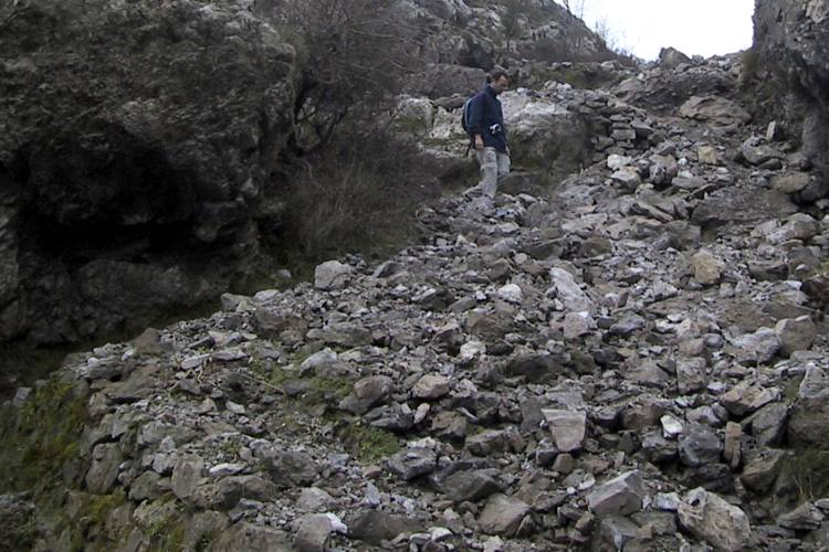
- a destra si va a Pogerola (o a Madonna dei Fuondi) percorrendo un lungo tratto panoramico pressoché in piano per poi scendere lungo un largo sentiero.
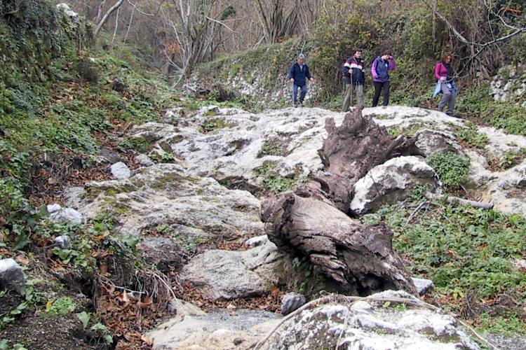
- proseguendo diritto, si continua a scendere e dopo aver superato una calcara (in discreto stato di conservazione) si giunge sul sentiero alto della Valle delle Ferriere. Quindi si potrà proseguire diritto fino a Scala o Pontone o girare a destra e scendere comodamente a Pogerola in una mezz'oretta (2km).
Da Pogerola si può proseguire e raggiungere Amalfi in meno di mezz'ora utilizzando una comoda e molto ben tenuta antica mulattiera.
|
HQmap: |
 |
 |
 |
 www.maratrail.com |
 www.giovistravels.com |
|
from Agerola to Amalfi San Lazzaro > Acquolella > Pogerola > Amalfi |
From San Lazzaro (Agerola), midway between the square and the outlook, turn up left following the sign Castello Lauritano. After a few meters on your right you'll pass the road leading to the so called castle (it's worth going there just for the view), but your route keeps going straight up till the end of the asphalt road (730m).
There you'll take a path still going straight up; when you get to the higher part of the hill, the trail levels out and Monte Murillo's peak (910m) is on your left, turn right going gently down. After about 500m you'll get to the switchback of a wider path that is part of the Alta Via dei Monti Lattari; follow the red-white signs straight down.
Shortly after, the trail levels and goes around the valley remaining at the same height. About 1.2km ahead, just before leaving the valley, the path to Madonna dei Fuondi begins on your right. Go straight towards the saddle of Monte Molegnano where the narrow valley of the Acquolella spring starts. At the end of the zigzag down the valley turn left and walk for about 500m till you get to a fork:
- turning right you can go to Pogerola (or Madonna dei Fuondi) along a scenic stretch almost level and then down a wide path, but with many loose stones.
- going straight on you'll gently descend passing by a pretty well preserved limekiln and (after 500m) get to the higher trail of Valle delle Ferriere. There you can continue straight to Scala or Pontone or turn right and reach Pogerola in about 30 minutes (2km).
From Pogerola you can either catch a bus to Amalfi or walk down there in another 30 minutes walking along a winding, stone-paved, well maintained muletrack.