|
Mont'Alto e Ieranto da Nerano a Jeranto, Mot'Alto e Penna |
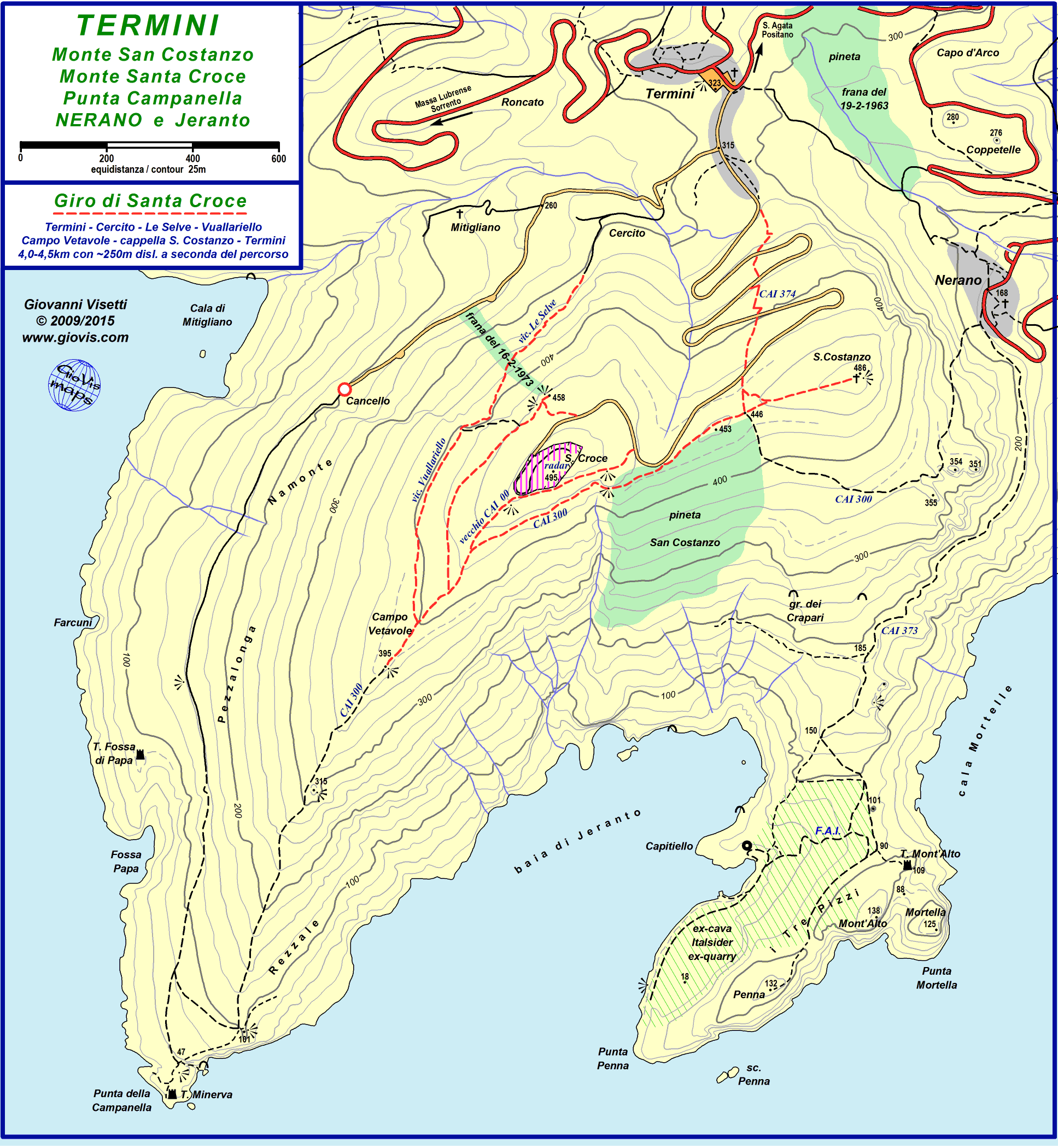
Dalla piazzetta di Nerano si segue per qualche decina di metri la rotabile verso Marina del Cantone e poi si imbocca a destra via Jeranto, un sentiero che ci condurrà verso la baia omonima, centro della Riserva Marina Protetta di Punta Campanella.
Dopo aver percorso circa 50 metri in leggera salita, sulla destra, si diparte il ripido sentiero (facente parte dell'Alta Via dei Monti Lattari - segnavia bianco/rosso) che conduce alla sella di Monte San Costanzo.
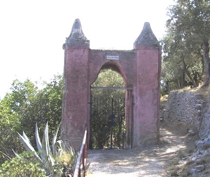
Via Jeranto continua invece più o meno in quota per circa 1 km passando accanto all'ingresso della cosiddetta Villa Rosa (dove soggiornò Norman Douglas) e successivamente davanti ad una originale edicola incassata nella roccia.
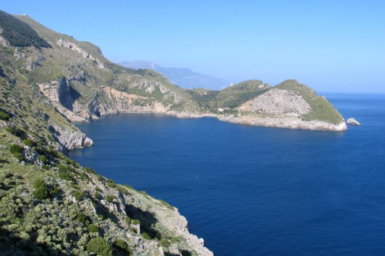
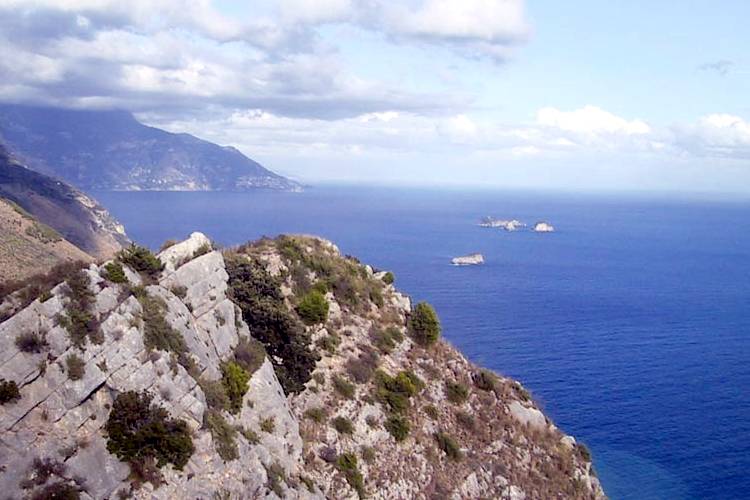
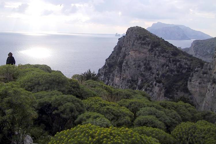
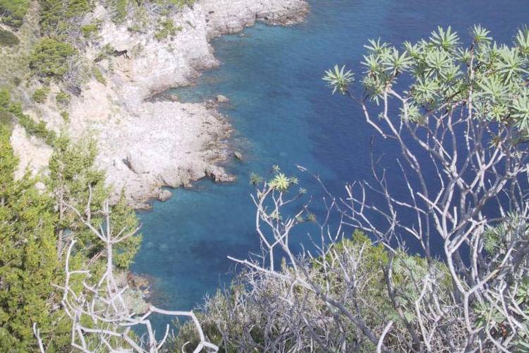
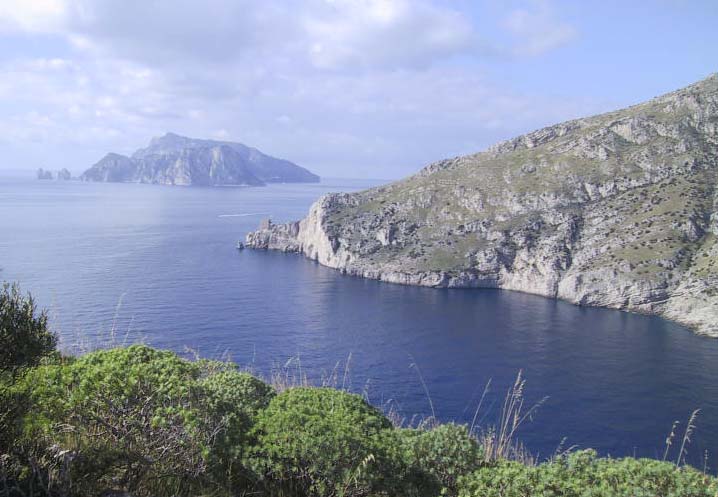
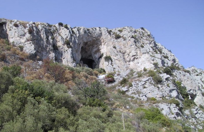
Lungo tutta questa prima parte del percorso si gode di splendide viste sulla baia del Cantone e sullo sfondo si stagliano nell'azzurro del mare l'isolotto di Vetara ed il mini arcipelago de Li Galli. In alto sulla destra si vede l'ingresso della Grotta delle Noglie.
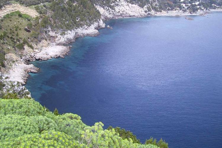
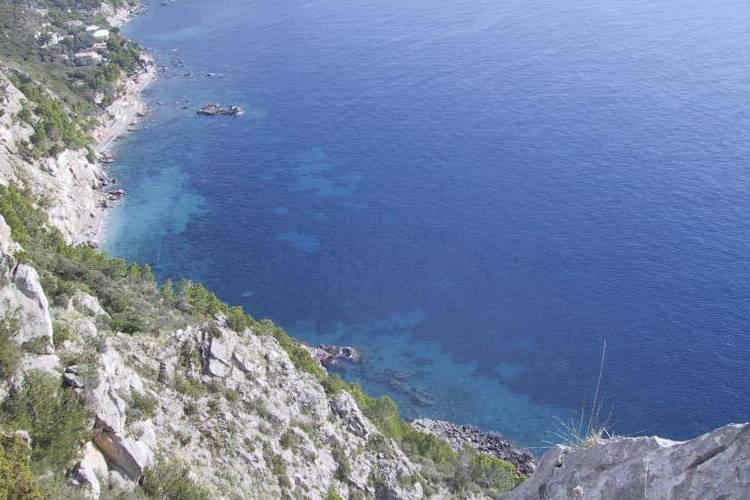
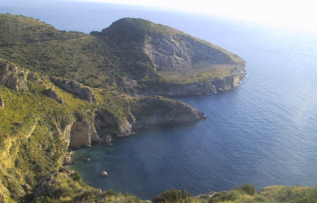
Man mano che ci si allontana da Nerano gli uliveti diventano meno frequenti e la macchia mediterranea prende il sopravvento. Dopo un tratto in discesa fra muretti a secco si giunge sul crinale di Sprito e la vista potrà spaziare da Capri con i Faraglioni, Punta della Campanella e Baia di Jeranto sulla destra a tutto il Golfo di Salerno fino a Punta Licosa (si vede chiaramente nei giorni con buona visibilità), la Costiera Amalfitana, Vetara e Li Galli a sinistra.
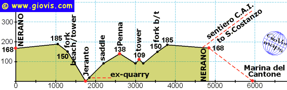
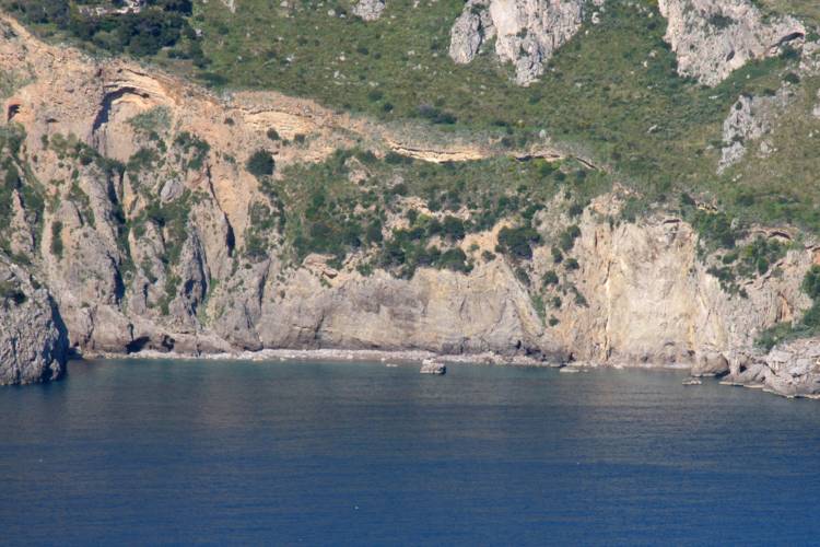
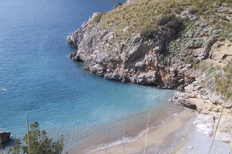
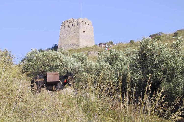
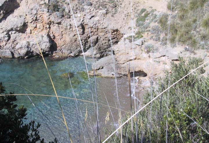
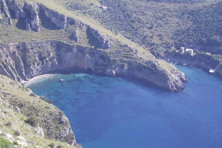
A questo punto siamo al bivio (segnalato, come tutto il sentiero 3, con segnavia giallo) per Mont'Alto e Penna a sinistra o per la spiaggetta di Jeranto a destra. La discesa verso il mare si sviluppa lungo la vecchia scalinata (piuttosto malandata) che conduceva alla cava. A sinistra invece inizia un sentiero sterrato che dopo un breve tratto in discesa prosegue, chiuso fra due recinzioni, verso la Torre di Mont'Alto. Questa strada comunale una volta era in condizioni molto migliori essendo a servizio della torre e di vari terreni del demanio comunale.
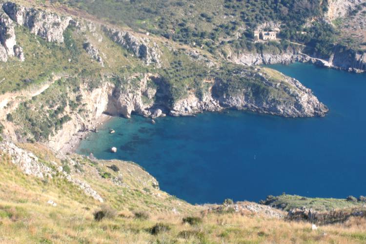
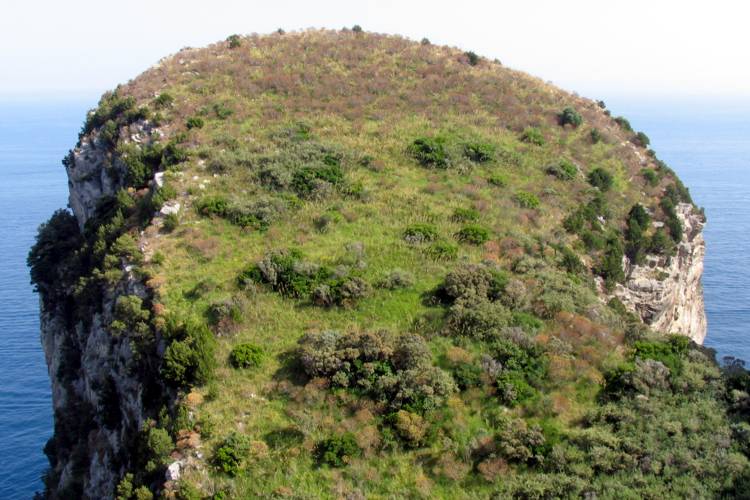
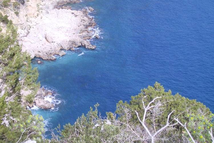
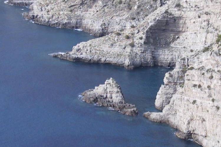
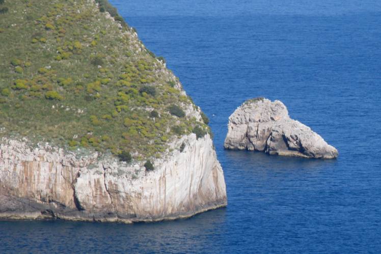
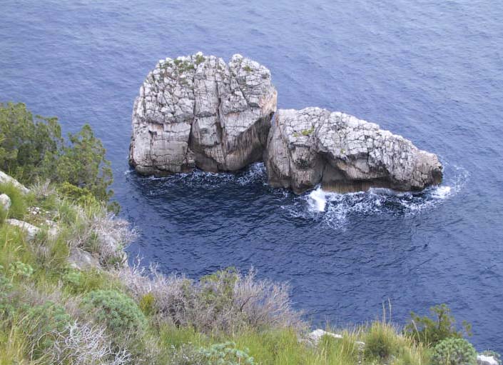
Alla base dell'altura sulla quale si erge la torre il sentiero gira a destra e prosegue. sempre in piano, fino alla sella prima di Penna, l'ultimo dei "Tre Pizzi" (gli altri due sono Mont'Alto e Mortella). Si può salire, con cautela, attraverso la macchia fino alla sommità dalla quale si avrà una vista della baia insolita ai più e molti scopriranno che il cosiddetto Scoglio a Penna è in realtà formato da due scogli molto vicini (o forse era uno solo è poi si è spaccato).
Per raggiungere tutti i punti più interessanti di questa escursione, suggerisco questo itinerario:
dal bivio scendere la scala dissestata fino alla spiaggia, dopo l'eventuale bagno salire alla piana della cava e poi (attraverso la proprietà F.A.I. - accesso libero) salire alla torre di Mont'Alto e a Penna. Ritornare sul sentiero per Nerano attraverso la vecchia strada comunale.
|
Video:Nerano - Jeranto (mattina-morning) Baia di Jeranto (pomeriggio-afternoon) HQmap: HQ *.pdf map |
 |
 |
 |
 |
 |
 www.maratrail.com |
 www.giovistravels.com |
|
Mont'Alto and Jeranto from Nerano a Jeranto, Mot'Alto e Penna |
From the small square of Nerano follow the main road for a few metres towards Marina del Cantone and then take the path on your right (yellow signs to Jeranto and red-white to S.Costanzo) that will lead you to the Bay of Jeranto, the focal point of the Natural Marine Reserve of Punta Campanella.
After a few meters uphill the red-white signs (Alta Via dei Monti Lattari) show you the way up to Monte S.Costanzo; keep following the yellow signs along the main path.
Along this level stretch of about 1 km you'll first pass the entrance to Villa Rosa (where Norman Douglas stayed) and then an unusual shrine built into the limestone.
This first part of the walk offers magnificent views over the Bay of Cantone with Vetara and the mini archipelago of Li Galli in the background. Up to the right you can see the entrance to the Grotta delle Noglie.
As you move away from Nerano the olive groves and the terraces become less frequent and the typical Mediterranean
scrub takes over.
After a short descent between dry-stone walls you come to the crest of Sprito with views encompassing Capri with the Faraglioni, Punta della Campanella and Baia di Jeranto on your right, the entire Gulf of Salerno as far as Punta Licosa (which can be clearly seen when visibility is good), the Amalfi Coast, Vetara and Li Galli on your left.
You are now at the fork (signed yellow as all path 3): Mont'Alto and Penna to the left and the small pebbled beach of Jeranto
to the right.
The descent towards the sea goes down ancient dilapidated steps which were once used by the quarrymen.
On the left the old public dirt path starts and after a short worn trail downhill it continues between a wire fence on the left and a wall on the right towards the Torre di Mont'Alto. This path was once in much better condition as it linked Nerano to the tower and several cultivated terraces.
At the foot of the hill with the tower turns towards the right continuing on a level till the saddle before the hill of Penna, the last of the so called Three Peaks (the others are Mont'Alto and Mortella).
You can climb (carefully) through the scrub to the top of Penna where you can have a view of the bay unknown to most people. Moreover you'll discover that the so called Scoglio a Penna is in fact formed by two separate rocks very close to each other (or perhaps by just one rock which split in two).
In order to reach all the most interesting sites of this excursion, I suggest the following route: at the fork go down the dilapidated steps to the beach; there you can have a swim before going up to the plateau of the former quarry. Then walk through the olive grove belonging to the F.A.I. (National Trust - free access) up to the tower and Penna. Finally walk up to the main path using the old public trail.
 |
 |
 |
 |
 |
 |
 |
|
 |
 |
 |
 |
 |
 |
 |